
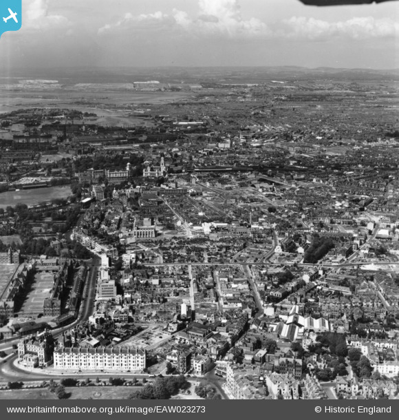
EAW023273 ENGLAND (1949). Cleared areas following bomb damage around Southsea, Somers Town and environs, Portsmouth, from the south, 1949. This image has been produced from a print.
© Copyright OpenStreetMap contributors and licensed by the OpenStreetMap Foundation. 2026. Cartography is licensed as CC BY-SA.
Details
| Title | [EAW023273] Cleared areas following bomb damage around Southsea, Somers Town and environs, Portsmouth, from the south, 1949. This image has been produced from a print. |
| Reference | EAW023273 |
| Date | 19-May-1949 |
| Link | |
| Place name | PORTSMOUTH |
| Parish | SOUTHSEA |
| District | |
| Country | ENGLAND |
| Easting / Northing | 463957, 99312 |
| Longitude / Latitude | -1.0925460990961, 50.789279302352 |
| National Grid Reference | SZ640993 |
Pins

redmist |
Tuesday 13th of December 2022 08:49:16 PM | |
|
Stephen Mirrington |
Tuesday 24th of August 2021 05:08:17 PM | |
|
brianbeckett |
Tuesday 12th of May 2020 04:51:49 PM | |
|
Matt |
Saturday 10th of October 2015 10:12:30 AM | |
|
Matt |
Saturday 10th of October 2015 10:11:52 AM | |
|
Matt |
Saturday 10th of October 2015 10:10:44 AM | |
|
NEOhoppy |
Thursday 4th of December 2014 03:30:08 AM | |
|
NEOhoppy |
Thursday 4th of December 2014 03:29:30 AM | |
|
NEOhoppy |
Thursday 4th of December 2014 03:26:16 AM | |
|
NEOhoppy |
Thursday 4th of December 2014 03:19:25 AM | |
|
NEOhoppy |
Thursday 4th of December 2014 03:17:15 AM | |
|
NEOhoppy |
Thursday 4th of December 2014 03:16:18 AM | |
This is Castle ROAD |
Matt |
Saturday 10th of October 2015 09:59:34 AM |
|
NEOhoppy |
Thursday 4th of December 2014 03:14:55 AM | |
|
NEOhoppy |
Thursday 4th of December 2014 03:13:23 AM | |
|
NEOhoppy |
Thursday 4th of December 2014 03:11:51 AM |