
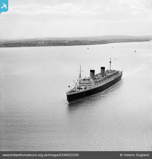
EAW022296 ENGLAND (1949). RMS Queen Elizabeth in the Solent between Stansore Point and Gurnard, Gurnard Bay, from the north-west, 1949
© Copyright OpenStreetMap contributors and licensed by the OpenStreetMap Foundation. 2026. Cartography is licensed as CC BY-SA.
Details
| Title | [EAW022296] RMS Queen Elizabeth in the Solent between Stansore Point and Gurnard, Gurnard Bay, from the north-west, 1949 |
| Reference | EAW022296 |
| Date | 18-April-1949 |
| Link | |
| Place name | GURNARD BAY |
| Parish | GURNARD |
| District | |
| Country | ENGLAND |
| Easting / Northing | 446792, 96877 |
| Longitude / Latitude | -1.3363810582268, 50.769021542076 |
| National Grid Reference | SZ468969 |
Pins
Be the first to add a comment to this image!