
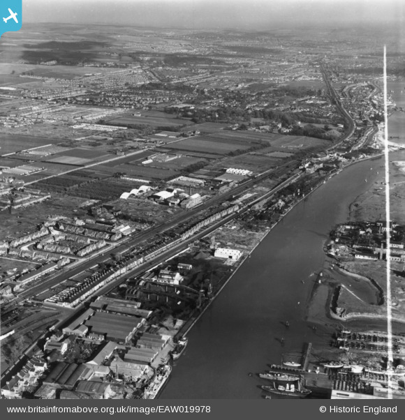
EAW019978 ENGLAND (1948). Shoreham Harbour, Brighton Road and environs, Kingston by Sea, from the south-west, 1948. This image has been produced from a print marked by Aerofilms Ltd for photo editing.
© Copyright OpenStreetMap contributors and licensed by the OpenStreetMap Foundation. 2026. Cartography is licensed as CC BY-SA.
Details
| Title | [EAW019978] Shoreham Harbour, Brighton Road and environs, Kingston by Sea, from the south-west, 1948. This image has been produced from a print marked by Aerofilms Ltd for photo editing. |
| Reference | EAW019978 |
| Date | 19-October-1948 |
| Link | |
| Place name | KINGSTON BY SEA |
| Parish | |
| District | |
| Country | ENGLAND |
| Easting / Northing | 522375, 105039 |
| Longitude / Latitude | -0.26208204363533, 50.831372239413 |
| National Grid Reference | TQ224050 |
Pins

Des |
Tuesday 3rd of December 2024 07:21:13 PM | |
|
Des |
Tuesday 3rd of December 2024 07:06:34 PM | |
|
Des |
Tuesday 3rd of December 2024 07:04:55 PM | |
|
Des |
Tuesday 3rd of December 2024 07:02:37 PM | |
|
Des |
Tuesday 3rd of December 2024 07:01:38 PM | |
|
Des |
Tuesday 3rd of December 2024 07:00:45 PM | |
|
Des |
Tuesday 3rd of December 2024 06:59:41 PM | |
|
Des |
Tuesday 3rd of December 2024 06:51:35 PM | |
|
Des |
Tuesday 3rd of December 2024 06:10:54 PM | |
|
ALAN S |
Friday 5th of February 2016 03:46:58 PM | |
|
ALAN S |
Friday 5th of February 2016 03:44:59 PM | |
|
ALAN S |
Friday 5th of February 2016 03:42:55 PM | |
|
ALAN S |
Friday 5th of February 2016 03:40:42 PM | |
|
ken |
Saturday 13th of June 2015 12:02:17 PM |