
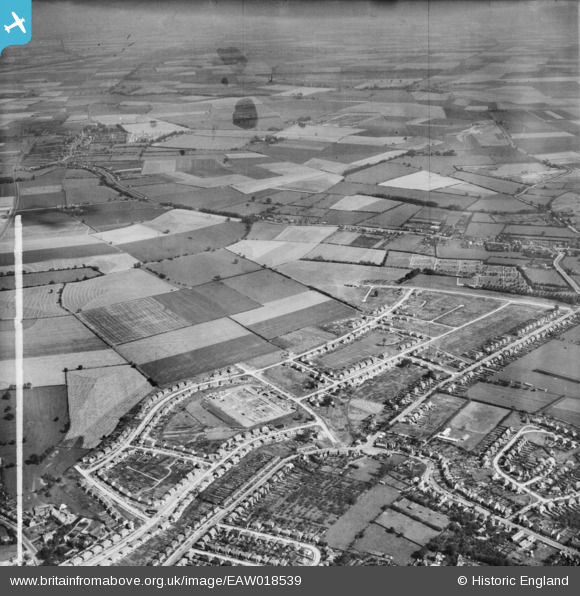
EAW018539 ENGLAND (1948). New housing development under construction around Central Avenue and environs, Dogsthorpe, 1948. This image was marked by Aerofilms Ltd for photo editing.
© Copyright OpenStreetMap contributors and licensed by the OpenStreetMap Foundation. 2026. Cartography is licensed as CC BY-SA.
Details
| Title | [EAW018539] New housing development under construction around Central Avenue and environs, Dogsthorpe, 1948. This image was marked by Aerofilms Ltd for photo editing. |
| Reference | EAW018539 |
| Date | 9-September-1948 |
| Link | |
| Place name | DOGSTHORPE |
| Parish | |
| District | |
| Country | ENGLAND |
| Easting / Northing | 520629, 301255 |
| Longitude / Latitude | -0.21888781441252, 52.595327980779 |
| National Grid Reference | TF206013 |
Pins

Great North Road |
Saturday 12th of December 2015 09:14:30 AM | |
|
Great North Road |
Saturday 12th of December 2015 09:13:00 AM | |

Class31 |
Tuesday 23rd of December 2014 08:11:16 AM | |
|
Class31 |
Tuesday 23rd of December 2014 08:10:08 AM | |
|
Class31 |
Wednesday 11th of June 2014 08:10:46 PM | |
|
Class31 |
Wednesday 11th of June 2014 08:06:14 PM | |
|
Class31 |
Wednesday 11th of June 2014 08:04:52 PM | |
|
Class31 |
Wednesday 11th of June 2014 09:05:17 AM |


