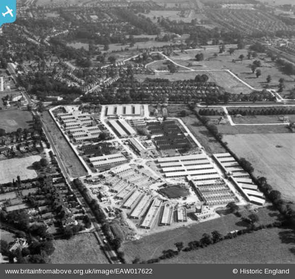
EAW017622 ENGLAND (1948). Construction work at Stanmore Outstation, Stanmore, 1948. This image has been produced from a print.
© Copyright OpenStreetMap contributors and licensed by the OpenStreetMap Foundation. 2026. Cartography is licensed as CC BY-SA.
Details
| Title | [EAW017622] Construction work at Stanmore Outstation, Stanmore, 1948. This image has been produced from a print. |
| Reference | EAW017622 |
| Date | 29-July-1948 |
| Link | |
| Place name | STANMORE |
| Parish | |
| District | |
| Country | ENGLAND |
| Easting / Northing | 518001, 192921 |
| Longitude / Latitude | -0.2952240143843, 51.622252854899 |
| National Grid Reference | TQ180929 |
Pins

Matt Aldred edob.mattaldred.com |
Thursday 11th of July 2024 10:49:19 AM | |

Matt Aldred edob.mattaldred.com |
Thursday 11th of July 2024 10:49:13 AM | |

Matt Aldred edob.mattaldred.com |
Thursday 11th of July 2024 10:49:01 AM | |

Matt Aldred edob.mattaldred.com |
Thursday 11th of July 2024 10:48:55 AM | |

Matt Aldred edob.mattaldred.com |
Thursday 11th of July 2024 10:47:29 AM | |

Matt Aldred edob.mattaldred.com |
Thursday 11th of July 2024 10:47:13 AM | |

Matt Aldred edob.mattaldred.com |
Thursday 11th of July 2024 10:46:46 AM | |

Matt Aldred edob.mattaldred.com |
Thursday 11th of July 2024 10:46:32 AM | |

Matt Aldred edob.mattaldred.com |
Thursday 11th of July 2024 10:46:07 AM | |

Matt Aldred edob.mattaldred.com |
Thursday 11th of July 2024 10:45:56 AM | |

Matt Aldred edob.mattaldred.com |
Thursday 11th of July 2024 10:45:34 AM | |

Matt Aldred edob.mattaldred.com |
Thursday 11th of July 2024 10:45:20 AM | |

Matt Aldred edob.mattaldred.com |
Thursday 11th of July 2024 10:44:45 AM | |

Digitalsnapper |
Tuesday 25th of January 2022 09:48:01 PM | |

Digitalsnapper |
Tuesday 25th of January 2022 09:33:15 PM | |

Graham |
Tuesday 15th of December 2020 11:35:37 AM | |

Mark Amies |
Monday 11th of June 2018 09:34:57 AM | |

ken |
Wednesday 20th of April 2016 04:01:49 PM | |

ken |
Wednesday 20th of April 2016 03:58:20 PM | |
Only the trolleybuses on route 645 to Barnet ran from Canons Park. Route 664 to Paddington Green and the 666 to Hammersmith ran as far as Edgware. The 645 was an unusual route in that most routes ran from a terminus on the outskirts to one in inner London whereas the 645 ran between two outer London terminals Canons Park and Barnet (via Cricklewood). Route 645 commenced operating on 2nd August 1936 and ran untill replaced by diesel buses on 3rd January 1962. |

Nowy Paul |
Sunday 4th of February 2018 03:12:58 PM |

ken |
Wednesday 20th of April 2016 03:57:03 PM | |

ken |
Wednesday 20th of April 2016 03:56:06 PM | |

ken |
Wednesday 20th of April 2016 03:55:23 PM | |

ken |
Wednesday 29th of July 2015 11:00:12 AM |


