
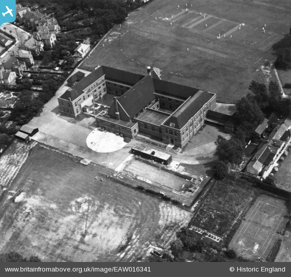
EAW016341 ENGLAND (1948). Queen Elizabeth's Grammar School, Barnet, 1948. This image has been produced from a print.
© Copyright OpenStreetMap contributors and licensed by the OpenStreetMap Foundation. 2026. Cartography is licensed as CC BY-SA.
Details
| Title | [EAW016341] Queen Elizabeth's Grammar School, Barnet, 1948. This image has been produced from a print. |
| Reference | EAW016341 |
| Date | 9-June-1948 |
| Link | |
| Place name | BARNET |
| Parish | |
| District | |
| Country | ENGLAND |
| Easting / Northing | 523731, 196730 |
| Longitude / Latitude | -0.21113746377237, 51.655256992658 |
| National Grid Reference | TQ237967 |
Pins

Matt Aldred edob.mattaldred.com |
Thursday 7th of March 2024 01:33:29 PM |