
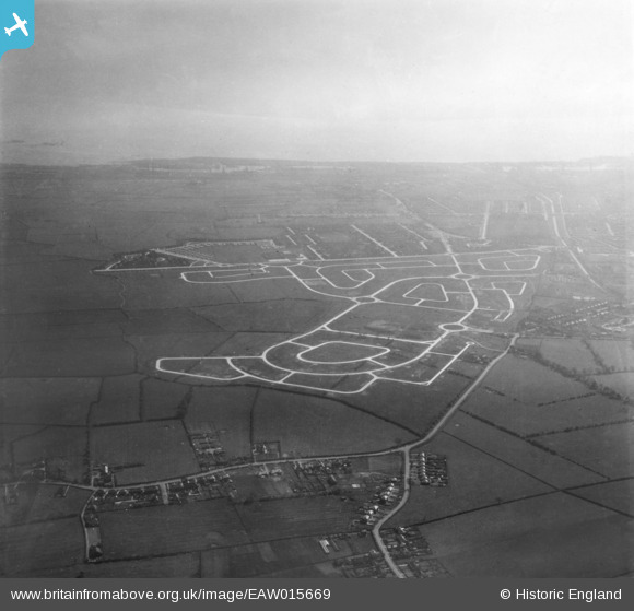
EAW015669 ENGLAND (1948). Construction of the Bilton Grange Estate, Kingston upon Hull, from the north, 1948. This image has been produced from a print.
© Copyright OpenStreetMap contributors and licensed by the OpenStreetMap Foundation. 2026. Cartography is licensed as CC BY-SA.
Details
| Title | [EAW015669] Construction of the Bilton Grange Estate, Kingston upon Hull, from the north, 1948. This image has been produced from a print. |
| Reference | EAW015669 |
| Date | 18-May-1948 |
| Link | |
| Place name | KINGSTON UPON HULL |
| Parish | |
| District | |
| Country | ENGLAND |
| Easting / Northing | 514808, 432556 |
| Longitude / Latitude | -0.25760277279927, 53.776445168171 |
| National Grid Reference | TA148326 |
Pins

redmist |
Friday 15th of October 2021 09:58:24 AM | |
|
John Wass |
Sunday 13th of January 2019 07:23:53 PM | |
|
John Wass |
Sunday 13th of January 2019 01:42:37 PM | |
|
John Wass |
Sunday 13th of January 2019 12:00:02 PM | |
|
kj5050 |
Wednesday 4th of January 2017 10:01:12 PM | |
|
kj5050 |
Wednesday 4th of January 2017 09:59:30 PM | |
|
kj5050 |
Wednesday 4th of January 2017 09:56:35 PM | |
|
Froobyone |
Monday 6th of October 2014 08:17:48 PM | |
|
Froobyone |
Monday 6th of October 2014 08:17:01 PM | |
|
Froobyone |
Monday 6th of October 2014 08:16:31 PM |