
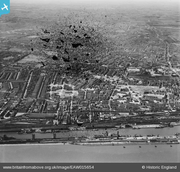
EAW015654 ENGLAND (1948). Albert Dock, Neptune Street Goods Station and the area around Walker Street, Kingston upon Hull, 1948. This image has been produced from a damaged negative.
© Copyright OpenStreetMap contributors and licensed by the OpenStreetMap Foundation. 2026. Cartography is licensed as CC BY-SA.
Details
| Title | [EAW015654] Albert Dock, Neptune Street Goods Station and the area around Walker Street, Kingston upon Hull, 1948. This image has been produced from a damaged negative. |
| Reference | EAW015654 |
| Date | 18-May-1948 |
| Link | |
| Place name | KINGSTON UPON HULL |
| Parish | |
| District | |
| Country | ENGLAND |
| Easting / Northing | 508617, 428484 |
| Longitude / Latitude | -0.35294979180194, 53.741185119546 |
| National Grid Reference | TA086285 |
Pins

redmist |
Friday 15th of October 2021 07:58:52 PM |