
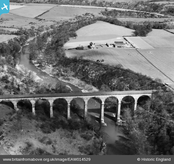
EAW014529 ENGLAND (1948). Belmont Viaduct, Belmont, 1948
© Copyright OpenStreetMap contributors and licensed by the OpenStreetMap Foundation. 2026. Cartography is licensed as CC BY-SA.
Details
| Title | [EAW014529] Belmont Viaduct, Belmont, 1948 |
| Reference | EAW014529 |
| Date | 15-April-1948 |
| Link | |
| Place name | BELMONT |
| Parish | BELMONT |
| District | |
| Country | ENGLAND |
| Easting / Northing | 429858, 545073 |
| Longitude / Latitude | -1.5355052000989, 54.799550128491 |
| National Grid Reference | NZ299451 |
Pins

NIGEL |
Sunday 22nd of November 2020 09:02:47 PM | |
|
NIGEL |
Sunday 22nd of November 2020 09:01:49 PM | |
|
NIGEL |
Sunday 22nd of November 2020 08:59:25 PM | |
|
NIGEL |
Sunday 22nd of November 2020 08:57:28 PM | |
|
NIGEL |
Sunday 22nd of November 2020 08:56:11 PM | |
|
NIGEL |
Sunday 22nd of November 2020 08:55:41 PM | |
|
NIGEL |
Sunday 22nd of November 2020 08:53:37 PM | |
|
NIGEL |
Sunday 22nd of November 2020 08:53:06 PM | |
|
itchard |
Friday 20th of January 2017 10:39:11 AM | |

Class31 |
Wednesday 20th of August 2014 09:27:30 AM |