
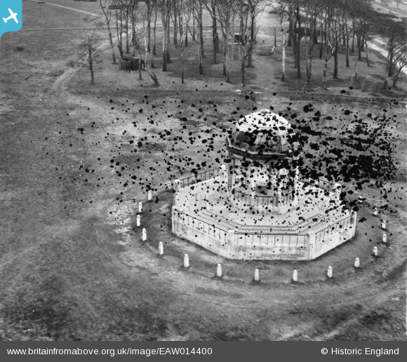
EAW014400 ENGLAND (1948). Barr Beacon War Memorial, Barr Beacon, 1948. This image has been produced from a damaged negative.
© Copyright OpenStreetMap contributors and licensed by the OpenStreetMap Foundation. 2026. Cartography is licensed as CC BY-SA.
Details
| Title | [EAW014400] Barr Beacon War Memorial, Barr Beacon, 1948. This image has been produced from a damaged negative. |
| Reference | EAW014400 |
| Date | 13-April-1948 |
| Link | |
| Place name | BARR BEACON |
| Parish | |
| District | |
| Country | ENGLAND |
| Easting / Northing | 406133, 297282 |
| Longitude / Latitude | -1.9094948574956, 52.57296557914 |
| National Grid Reference | SP061973 |
Pins
Be the first to add a comment to this image!