
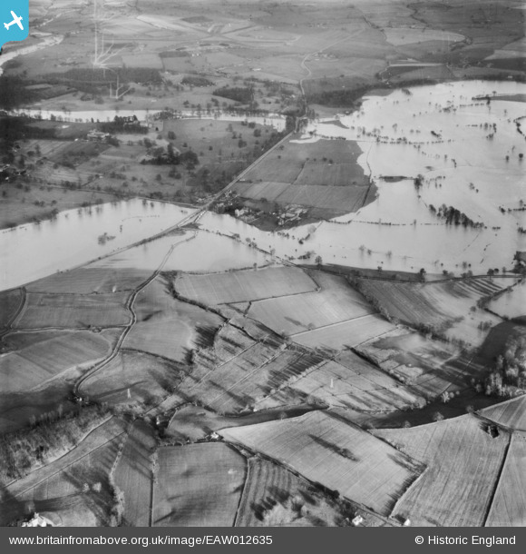
EAW012635 ENGLAND (1948). The River Severn in flood, Atcham, 1948
© Copyright OpenStreetMap contributors and licensed by the OpenStreetMap Foundation. 2026. Cartography is licensed as CC BY-SA.
Details
| Title | [EAW012635] The River Severn in flood, Atcham, 1948 |
| Reference | EAW012635 |
| Date | 14-January-1948 |
| Link | |
| Place name | ATCHAM |
| Parish | ATCHAM |
| District | |
| Country | ENGLAND |
| Easting / Northing | 353750, 309037 |
| Longitude / Latitude | -2.6841347389781, 52.676712632769 |
| National Grid Reference | SJ538090 |
Pins

Matt Aldred edob.mattaldred.com |
Monday 19th of May 2025 01:23:17 PM | |
|
Matt Aldred edob.mattaldred.com |
Friday 28th of March 2025 10:25:47 PM | |

Andrew Bennett |
Saturday 12th of April 2014 12:52:34 AM | |
|
Andrew Bennett |
Saturday 12th of April 2014 12:52:10 AM | |
|
Andrew Bennett |
Saturday 12th of April 2014 12:50:53 AM | |
|
Andrew Bennett |
Saturday 12th of April 2014 12:46:27 AM | |
|
Andrew Bennett |
Saturday 12th of April 2014 12:44:45 AM | |
|
Andrew Bennett |
Saturday 12th of April 2014 12:44:04 AM |