
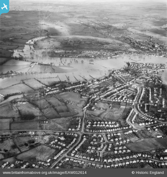
EAW012614 ENGLAND (1948). The River Severn in flood at Copthorne and Frankwell, Shrewsbury, 1948. This image has been produced from a damaged negative.
© Copyright OpenStreetMap contributors and licensed by the OpenStreetMap Foundation. 2026. Cartography is licensed as CC BY-SA.
Details
| Title | [EAW012614] The River Severn in flood at Copthorne and Frankwell, Shrewsbury, 1948. This image has been produced from a damaged negative. |
| Reference | EAW012614 |
| Date | 14-January-1948 |
| Link | |
| Place name | SHREWSBURY |
| Parish | SHREWSBURY |
| District | |
| Country | ENGLAND |
| Easting / Northing | 348014, 313074 |
| Longitude / Latitude | -2.7696123616577, 52.712484711238 |
| National Grid Reference | SJ480131 |
