
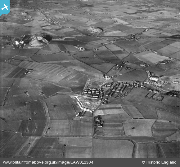
EAW012304 ENGLAND (1947). The village and surrounding countryside, Burtonwood, 1947. This image has been produced from a print.
© Copyright OpenStreetMap contributors and licensed by the OpenStreetMap Foundation. 2026. Cartography is licensed as CC BY-SA.
Details
| Title | [EAW012304] The village and surrounding countryside, Burtonwood, 1947. This image has been produced from a print. |
| Reference | EAW012304 |
| Date | 26-November-1947 |
| Link | |
| Place name | BURTONWOOD |
| Parish | BURTONWOOD AND WESTBROOK |
| District | |
| Country | ENGLAND |
| Easting / Northing | 355998, 392867 |
| Longitude / Latitude | -2.6623403938065, 53.430493491412 |
| National Grid Reference | SJ560929 |
Pins

NeilRobertson |
Friday 1st of October 2021 08:40:26 PM | |
|
NeilRobertson |
Friday 1st of October 2021 08:39:03 PM | |
|
NeilRobertson |
Friday 1st of October 2021 08:38:42 PM | |
|
ian |
Thursday 24th of October 2019 04:50:51 PM |