
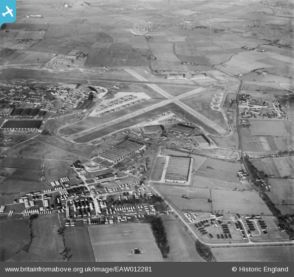
EAW012281 ENGLAND (1947). RAF Burtonwood, Burtonwood, 1947
© Copyright OpenStreetMap contributors and licensed by the OpenStreetMap Foundation. 2026. Cartography is licensed as CC BY-SA.
Details
| Title | [EAW012281] RAF Burtonwood, Burtonwood, 1947 |
| Reference | EAW012281 |
| Date | 26-November-1947 |
| Link | |
| Place name | BURTONWOOD |
| Parish | BURTONWOOD AND WESTBROOK |
| District | |
| Country | ENGLAND |
| Easting / Northing | 356826, 390303 |
| Longitude / Latitude | -2.6495264777814, 53.40751413622 |
| National Grid Reference | SJ568903 |
Pins

Ginger79 |
Monday 29th of March 2021 07:45:11 PM | |
|
Ginger79 |
Monday 8th of March 2021 09:58:02 PM | |
|
Ginger79 |
Monday 8th of March 2021 09:56:23 PM | |
|
Ginger79 |
Monday 8th of March 2021 09:55:39 PM | |
|
Ginger79 |
Monday 8th of March 2021 09:54:50 PM | |
|
Ginger79 |
Monday 8th of March 2021 09:54:04 PM | |
|
Ginger79 |
Monday 8th of March 2021 09:51:41 PM | |

mostyn |
Tuesday 21st of October 2014 11:51:46 AM | |
|
curnock |
Friday 15th of November 2013 03:13:57 PM |


User Comment Contributions
Large numbers of aircraft lined up on hard standings, probably redundant after World War II |
MB |
Sunday 24th of November 2013 04:17:35 PM |