
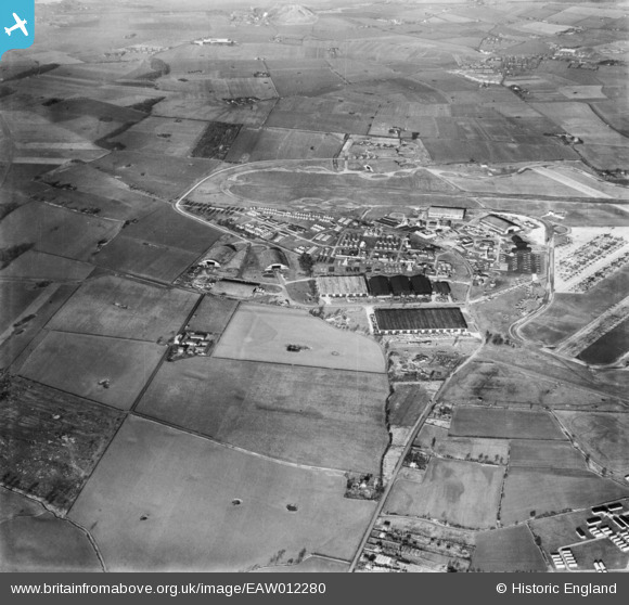
EAW012280 ENGLAND (1947). RAF Burtonwood, Burtonwood, 1947
© Copyright OpenStreetMap contributors and licensed by the OpenStreetMap Foundation. 2026. Cartography is licensed as CC BY-SA.
Details
| Title | [EAW012280] RAF Burtonwood, Burtonwood, 1947 |
| Reference | EAW012280 |
| Date | 26-November-1947 |
| Link | |
| Place name | BURTONWOOD |
| Parish | BURTONWOOD AND WESTBROOK |
| District | |
| Country | ENGLAND |
| Easting / Northing | 355867, 390514 |
| Longitude / Latitude | -2.6639825316569, 53.409331476708 |
| National Grid Reference | SJ559905 |
Pins

balloon no3 |
Monday 6th of December 2021 05:53:12 PM | |
|
balloon no3 |
Monday 6th of December 2021 05:51:41 PM | |

Ginger79 |
Monday 29th of March 2021 07:39:20 PM | |
|
Ginger79 |
Monday 8th of March 2021 09:49:48 PM | |
|
Ginger79 |
Monday 8th of March 2021 09:47:26 PM | |
|
Ginger79 |
Monday 8th of March 2021 09:46:48 PM | |
|
cptpies |
Tuesday 19th of December 2017 09:24:53 AM |
