
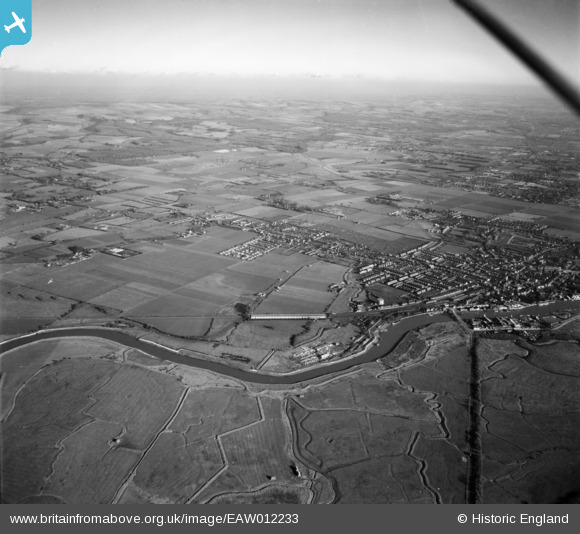
EAW012233 ENGLAND (1947). The River Arun and the town, Littlehampton, from the west, 1947
© Copyright OpenStreetMap contributors and licensed by the OpenStreetMap Foundation. 2025. Cartography is licensed as CC BY-SA.
Details
| Title | [EAW012233] The River Arun and the town, Littlehampton, from the west, 1947 |
| Reference | EAW012233 |
| Date | 24-November-1947 |
| Link | |
| Place name | LITTLEHAMPTON |
| Parish | LITTLEHAMPTON |
| District | |
| Country | ENGLAND |
| Easting / Northing | 501667, 102526 |
| Longitude / Latitude | -0.55675525168913, 50.812787477276 |
| National Grid Reference | TQ017025 |
Pins

redmist |
Monday 27th of June 2022 10:51:45 PM | |
|
redmist |
Monday 27th of June 2022 10:50:36 PM | |
|
timd |
Friday 6th of November 2020 03:57:34 PM | |

Sparky |
Saturday 30th of September 2017 09:49:26 PM | |
|
Sparky |
Saturday 30th of September 2017 09:48:55 PM | |
|
Sparky |
Saturday 30th of September 2017 09:48:34 PM |