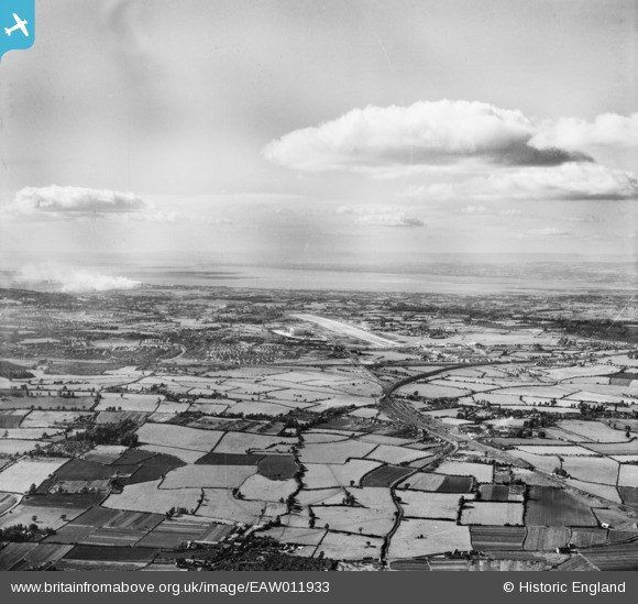
EAW011933 ENGLAND (1947). Bristol Filton Airport and the surrounding area, Stoke Gifford, from the east, 1947
© Copyright OpenStreetMap contributors and licensed by the OpenStreetMap Foundation. 2025. Cartography is licensed as CC BY-SA.
Details
| Title | [EAW011933] Bristol Filton Airport and the surrounding area, Stoke Gifford, from the east, 1947 |
| Reference | EAW011933 |
| Date | 15-October-1947 |
| Link | |
| Place name | STOKE GIFFORD |
| Parish | STOKE GIFFORD |
| District | |
| Country | ENGLAND |
| Easting / Northing | 362739, 179268 |
| Longitude / Latitude | -2.5369816681241, 51.510627484473 |
| National Grid Reference | ST627793 |
Pins
 JC2018 |
Tuesday 4th of February 2020 02:55:48 PM | |
 Geoff |
Wednesday 30th of July 2014 03:51:39 PM | |
 Geoff |
Wednesday 30th of July 2014 03:44:54 PM | |
 Geoff |
Wednesday 30th of July 2014 03:41:35 PM | |
 Geoff |
Monday 21st of July 2014 03:37:19 PM | |
 Class31 |
Saturday 22nd of March 2014 07:29:49 PM | |
 Class31 |
Saturday 22nd of March 2014 07:28:07 PM | |
 Class31 |
Saturday 22nd of March 2014 07:27:14 PM | |
 Class31 |
Saturday 22nd of March 2014 07:25:28 PM | |
 Class31 |
Saturday 22nd of March 2014 07:21:59 PM | |
 Class31 |
Saturday 22nd of March 2014 07:18:28 PM | |
 Class31 |
Saturday 22nd of March 2014 07:14:15 PM | |
 Class31 |
Saturday 22nd of March 2014 07:12:29 PM | |
 Class31 |
Saturday 22nd of March 2014 07:05:11 PM |

