
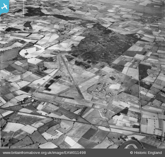
EAW011498 ENGLAND (1947). RAF Riccall Airfield, Riccall Common, 1947
© Copyright OpenStreetMap contributors and licensed by the OpenStreetMap Foundation. 2026. Cartography is licensed as CC BY-SA.
Details
| Title | [EAW011498] RAF Riccall Airfield, Riccall Common, 1947 |
| Reference | EAW011498 |
| Date | 24-September-1947 |
| Link | |
| Place name | RICCALL COMMON |
| Parish | RICCALL |
| District | |
| Country | ENGLAND |
| Easting / Northing | 464212, 436797 |
| Longitude / Latitude | -1.0244239270417, 53.823261484206 |
| National Grid Reference | SE642368 |
Pins

Matt Aldred edob.mattaldred.com |
Thursday 8th of May 2025 03:52:45 PM | |
|
Matt Aldred edob.mattaldred.com |
Thursday 8th of May 2025 03:52:34 PM | |
|
Matt Aldred edob.mattaldred.com |
Monday 31st of March 2025 10:59:01 AM | |
|
Matt Aldred edob.mattaldred.com |
Monday 31st of March 2025 10:57:38 AM | |
|
Matt Aldred edob.mattaldred.com |
Monday 31st of March 2025 10:57:22 AM | |

PinzaC55 |
Tuesday 6th of September 2022 10:51:23 AM | |
|
PinzaC55 |
Tuesday 6th of September 2022 10:47:54 AM | |
|
nick |
Tuesday 14th of July 2020 09:25:57 PM |