
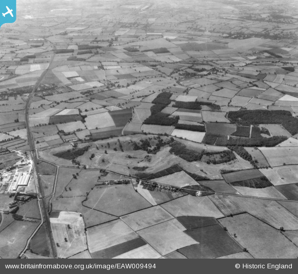
EAW009494 ENGLAND (1947). Rushcliffe Golf Course and surrounding countryside, Gotham, from the north-east, 1947. This image has been produced from a print.
© Copyright OpenStreetMap contributors and licensed by the OpenStreetMap Foundation. 2026. Cartography is licensed as CC BY-SA.
Details
| Title | [EAW009494] Rushcliffe Golf Course and surrounding countryside, Gotham, from the north-east, 1947. This image has been produced from a print. |
| Reference | EAW009494 |
| Date | 19-August-1947 |
| Link | |
| Place name | GOTHAM |
| Parish | GOTHAM |
| District | |
| Country | ENGLAND |
| Easting / Northing | 454808, 328537 |
| Longitude / Latitude | -1.1860248989351, 52.851213078973 |
| National Grid Reference | SK548285 |
Pins
 Ex Great Central railways "Rushcliffe Platform" on their London Extension line. Ex Great Central railways "Rushcliffe Platform" on their London Extension line. |

John Wass |
Saturday 12th of December 2015 07:37:14 PM |