
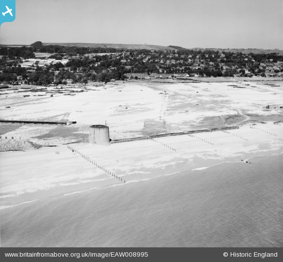
EAW008995 ENGLAND (1947). Martello Tower No 15 and the Hythe Ranges, Hythe, from the south, 1947
© Copyright OpenStreetMap contributors and licensed by the OpenStreetMap Foundation. 2025. Cartography is licensed as CC BY-SA.
Details
| Title | [EAW008995] Martello Tower No 15 and the Hythe Ranges, Hythe, from the south, 1947 |
| Reference | EAW008995 |
| Date | 12-August-1947 |
| Link | |
| Place name | HYTHE |
| Parish | HYTHE |
| District | |
| Country | ENGLAND |
| Easting / Northing | 615227, 133633 |
| Longitude / Latitude | 1.0718778675226, 51.061093782265 |
| National Grid Reference | TR152336 |
Pins

cptpies |
Tuesday 10th of October 2017 02:42:37 PM | |
|
The Laird |
Tuesday 14th of April 2015 05:00:43 PM | |
|
The Laird |
Tuesday 14th of April 2015 04:53:41 PM | |
|
The Laird |
Tuesday 14th of April 2015 04:48:59 PM | |
|
The Laird |
Tuesday 14th of April 2015 04:46:52 PM |