
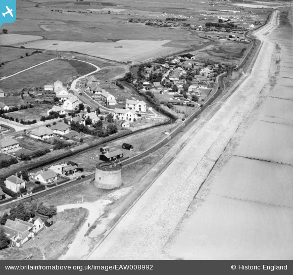
EAW008992 ENGLAND (1947). Martello Towers No 22 and 23, Dymchurch, 1947
© Copyright OpenStreetMap contributors and licensed by the OpenStreetMap Foundation. 2025. Cartography is licensed as CC BY-SA.
Details
| Title | [EAW008992] Martello Towers No 22 and 23, Dymchurch, 1947 |
| Reference | EAW008992 |
| Date | 12-August-1947 |
| Link | |
| Place name | DYMCHURCH |
| Parish | DYMCHURCH |
| District | |
| Country | ENGLAND |
| Easting / Northing | 611323, 130535 |
| Longitude / Latitude | 1.0144323447203, 51.034721669638 |
| National Grid Reference | TR113305 |
Pins

Bob Labrax |
Monday 16th of December 2024 03:15:35 PM | |
|
Bob Labrax |
Monday 16th of December 2024 03:14:37 PM | |
|
Bob Labrax |
Monday 16th of December 2024 03:13:56 PM | |
|
Bob Labrax |
Monday 16th of December 2024 03:12:02 PM | |

Sparky |
Thursday 6th of July 2017 09:40:38 AM | |
|
Sparky |
Thursday 6th of July 2017 12:35:48 AM | |
|
Sparky |
Thursday 6th of July 2017 12:32:32 AM | |
|
Sparky |
Thursday 6th of July 2017 12:28:53 AM | |
|
Sparky |
Thursday 6th of July 2017 12:26:09 AM | |
|
Sparky |
Thursday 6th of July 2017 12:24:27 AM |