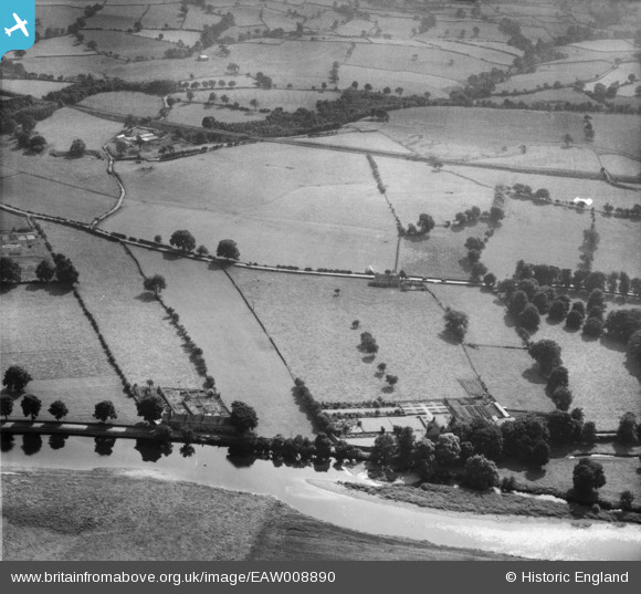
EAW008890 ENGLAND (1947). Holme House and Low Holme House, Addingham, 1947
© Copyright OpenStreetMap contributors and licensed by the OpenStreetMap Foundation. 2024. Cartography is licensed as CC BY-SA.
Nearby Images (7)
Details
| Title | [EAW008890] Holme House and Low Holme House, Addingham, 1947 |
| Reference | EAW008890 |
| Date | 9-August-1947 |
| Link | |
| Place name | ADDINGHAM |
| Parish | ADDINGHAM |
| District | |
| Country | ENGLAND |
| Easting / Northing | 408731, 449272 |
| Longitude / Latitude | -1.8669836114477, 53.939290919195 |
| National Grid Reference | SE087493 |


![[EAW008890] Holme House and Low Holme House, Addingham, 1947](http://britainfromabove.org.uk/sites/all/libraries/aerofilms-images/public/100x100/EAW/008/EAW008890.jpg)
![[EAW008888] Fields between the Skipton and Ilkley Branch Railway and Hallcroft Hall, Addingham, 1947](http://britainfromabove.org.uk/sites/all/libraries/aerofilms-images/public/100x100/EAW/008/EAW008888.jpg)
![[EAW008886] Fields between the Skipton and Ilkley Branch Railway and Hallcroft Hall, Addingham, 1947](http://britainfromabove.org.uk/sites/all/libraries/aerofilms-images/public/100x100/EAW/008/EAW008886.jpg)
![[EAW008889] Holme House and Low Holme House, Addingham, 1947. This image was marked by Aerofilms Ltd for photo editing.](http://britainfromabove.org.uk/sites/all/libraries/aerofilms-images/public/100x100/EAW/008/EAW008889.jpg)
![[EAW008887] Fields between the Skipton and Ilkley Branch Railway and Hallcroft Hall, Addingham, 1947](http://britainfromabove.org.uk/sites/all/libraries/aerofilms-images/public/100x100/EAW/008/EAW008887.jpg)
![[EAW008894] Holme House, Addingham, 1947](http://britainfromabove.org.uk/sites/all/libraries/aerofilms-images/public/100x100/EAW/008/EAW008894.jpg)
![[EAW008892] Holme House, Addingham, 1947](http://britainfromabove.org.uk/sites/all/libraries/aerofilms-images/public/100x100/EAW/008/EAW008892.jpg)
