
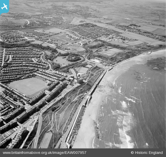
EAW007957 ENGLAND (1947). Northstead and Newlands, Scarborough, from the south-east, 1947
© Copyright OpenStreetMap contributors and licensed by the OpenStreetMap Foundation. 2026. Cartography is licensed as CC BY-SA.
Details
| Title | [EAW007957] Northstead and Newlands, Scarborough, from the south-east, 1947 |
| Reference | EAW007957 |
| Date | 26-June-1947 |
| Link | |
| Place name | SCARBOROUGH |
| Parish | |
| District | |
| Country | ENGLAND |
| Easting / Northing | 504095, 489436 |
| Longitude / Latitude | -0.40061738006863, 54.289775198296 |
| National Grid Reference | TA041894 |
Pins

Matt Aldred edob.mattaldred.com |
Tuesday 7th of July 2026 05:03:55 PM | |
|
Matt Aldred edob.mattaldred.com |
Tuesday 7th of July 2026 05:02:59 PM | |

garfield70 |
Thursday 11th of February 2021 03:22:33 PM | |
|
garfield70 |
Thursday 11th of February 2021 03:21:53 PM | |
|
John Wass |
Tuesday 2nd of January 2018 02:55:17 PM | |
|
Chris101 |
Sunday 3rd of December 2017 10:16:25 PM | |
|
Chris101 |
Sunday 11th of September 2016 01:12:45 PM | |
|
Chris101 |
Sunday 11th of September 2016 01:09:56 PM | |
|
Chris101 |
Sunday 11th of September 2016 01:08:31 PM | |
|
garfield70 |
Wednesday 31st of August 2016 12:47:26 PM | |
|
garfield70 |
Wednesday 23rd of December 2015 09:36:53 PM | |
|
garfield70 |
Wednesday 23rd of December 2015 09:35:23 PM | |
|
garfield70 |
Monday 1st of June 2015 01:25:41 PM |