
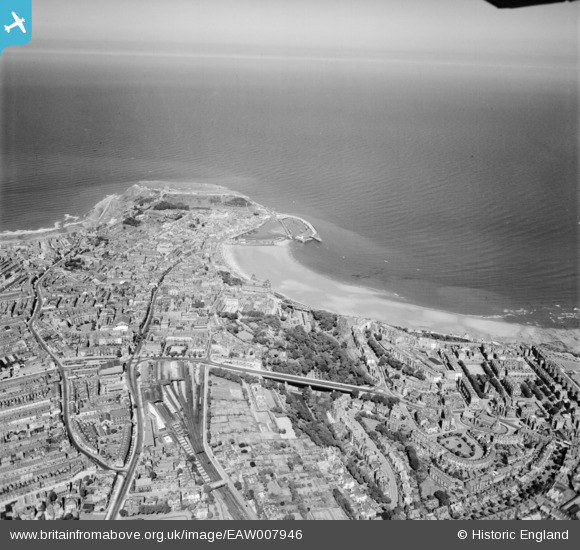
EAW007946 ENGLAND (1947). The town centre, South Bay and the headland, Scarborough, from the south-west, 1947
© Copyright OpenStreetMap contributors and licensed by the OpenStreetMap Foundation. 2026. Cartography is licensed as CC BY-SA.
Details
| Title | [EAW007946] The town centre, South Bay and the headland, Scarborough, from the south-west, 1947 |
| Reference | EAW007946 |
| Date | 26-June-1947 |
| Link | |
| Place name | SCARBOROUGH |
| Parish | |
| District | |
| Country | ENGLAND |
| Easting / Northing | 504028, 488078 |
| Longitude / Latitude | -0.40211873747506, 54.277587502219 |
| National Grid Reference | TA040881 |
Pins

Mullenaround |
Wednesday 23rd of July 2025 08:58:54 PM | |
|
Mullenaround |
Friday 31st of January 2025 01:05:51 PM | |
|
Mullenaround |
Friday 31st of January 2025 01:00:42 PM | |
|
Mullenaround |
Friday 31st of January 2025 12:57:59 PM | |

redmist |
Thursday 12th of September 2019 08:11:05 PM | |
|
Brigham |
Thursday 23rd of July 2015 04:53:50 PM |