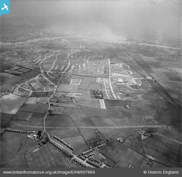
EAW007884 ENGLAND (1947). Housing surrounding Billy Mill and West Chirton, North Shields, from the north-west, 1947
© Copyright OpenStreetMap contributors and licensed by the OpenStreetMap Foundation. 2026. Cartography is licensed as CC BY-SA.
Details
| Title | [EAW007884] Housing surrounding Billy Mill and West Chirton, North Shields, from the north-west, 1947 |
| Reference | EAW007884 |
| Date | 27-June-1947 |
| Link | |
| Place name | NORTH SHIELDS |
| Parish | |
| District | |
| Country | ENGLAND |
| Easting / Northing | 433040, 569751 |
| Longitude / Latitude | -1.4831720353876, 55.021131485972 |
| National Grid Reference | NZ330698 |
Pins

ritalee |
Monday 22nd of September 2025 09:40:57 PM | |

ritalee |
Monday 22nd of September 2025 09:37:38 PM | |

robn |
Friday 6th of September 2024 06:33:22 PM | |

robn |
Friday 6th of September 2024 06:26:13 PM | |

robn |
Friday 6th of September 2024 06:24:10 PM | |

donalexander |
Saturday 2nd of August 2014 09:17:18 AM | |

donalexander |
Saturday 2nd of August 2014 09:15:28 AM | |

bellringer |
Wednesday 4th of June 2014 02:26:11 PM | |

bellringer |
Wednesday 4th of June 2014 02:25:52 PM |

