
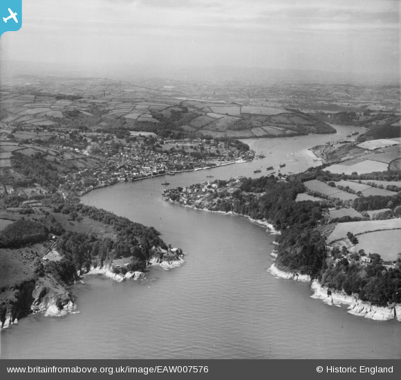
EAW007576 ENGLAND (1947). Dartmouth Harbour, Dartmouth, from the south-east, 1947
© Copyright OpenStreetMap contributors and licensed by the OpenStreetMap Foundation. 2025. Cartography is licensed as CC BY-SA.
Details
| Title | [EAW007576] Dartmouth Harbour, Dartmouth, from the south-east, 1947 |
| Reference | EAW007576 |
| Date | 25-June-1947 |
| Link | |
| Place name | DARTMOUTH |
| Parish | DARTMOUTH |
| District | |
| Country | ENGLAND |
| Easting / Northing | 288780, 50363 |
| Longitude / Latitude | -3.5632012819857, 50.342057622017 |
| National Grid Reference | SX888504 |
Pins

redmist |
Saturday 26th of November 2022 08:17:28 PM | |
|
redmist |
Saturday 26th of November 2022 08:15:55 PM | |
|
redmist |
Saturday 26th of November 2022 08:13:04 PM | |
|
redmist |
Saturday 26th of November 2022 08:12:26 PM | |
|
redmist |
Saturday 26th of November 2022 08:11:43 PM | |
|
redmist |
Saturday 26th of November 2022 07:53:41 PM | |
|
redmist |
Sunday 24th of July 2022 11:47:59 PM | |
|
redmist |
Sunday 24th of July 2022 11:42:40 PM | |
|
rivermersey |
Friday 26th of June 2020 08:48:57 PM | |
|
cptpies |
Wednesday 20th of September 2017 09:55:47 AM | |
|
GZ |
Tuesday 1st of March 2016 08:19:48 PM | |
|
Al |
Thursday 5th of December 2013 12:30:25 AM | |
BOP or BCP is a battery observation / command post - fire control for the gun battery |
Al |
Friday 20th of December 2013 09:32:12 AM |
|
Al |
Thursday 5th of December 2013 12:30:01 AM | |
a CASL is a coast artillery search light used to illuminate the sea to aid in target acquisition |
Al |
Friday 20th of December 2013 09:33:04 AM |