
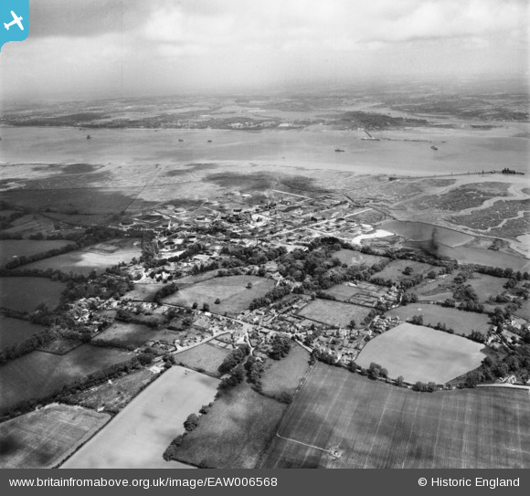
EAW006568 ENGLAND (1947). Fawley Oil Refinery and environs, Fawley, from the south-west, 1947
© Copyright OpenStreetMap contributors and licensed by the OpenStreetMap Foundation. 2025. Cartography is licensed as CC BY-SA.
Details
| Title | [EAW006568] Fawley Oil Refinery and environs, Fawley, from the south-west, 1947 |
| Reference | EAW006568 |
| Date | 27-May-1947 |
| Link | |
| Place name | FAWLEY |
| Parish | FAWLEY |
| District | |
| Country | ENGLAND |
| Easting / Northing | 445934, 103274 |
| Longitude / Latitude | -1.3477483198715, 50.826618396901 |
| National Grid Reference | SU459033 |
Pins

brooklander |
Thursday 5th of June 2025 04:56:18 PM | |
|
lesliesmith |
Sunday 24th of September 2023 07:42:20 AM | |
|
Simon Hoare |
Friday 25th of March 2022 07:30:19 PM | |
|
Simon Hoare |
Friday 25th of March 2022 07:29:20 PM | |
|
Mo |
Monday 22nd of June 2020 11:28:00 PM |