
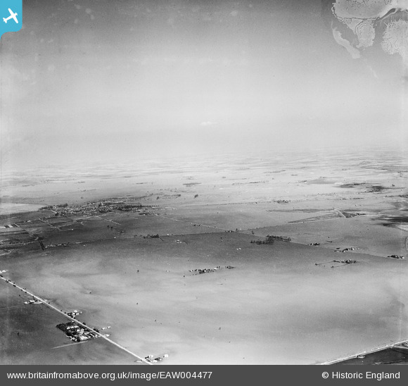
EAW004477 ENGLAND (1947). The town surrounded by flood waters, Crowland, from the south-west, 1947
© Copyright OpenStreetMap contributors and licensed by the OpenStreetMap Foundation. 2026. Cartography is licensed as CC BY-SA.
Details
| Title | [EAW004477] The town surrounded by flood waters, Crowland, from the south-west, 1947 |
| Reference | EAW004477 |
| Date | 16-April-1947 |
| Link | |
| Place name | CROWLAND |
| Parish | BOROUGH FEN |
| District | |
| Country | ENGLAND |
| Easting / Northing | 522834, 307112 |
| Longitude / Latitude | -0.18417070250372, 52.647466678897 |
| National Grid Reference | TF228071 |
Pins

Matt Aldred edob.mattaldred.com |
Monday 14th of March 2022 09:17:18 PM | |
|
Matt Aldred edob.mattaldred.com |
Monday 14th of March 2022 09:13:29 PM |