
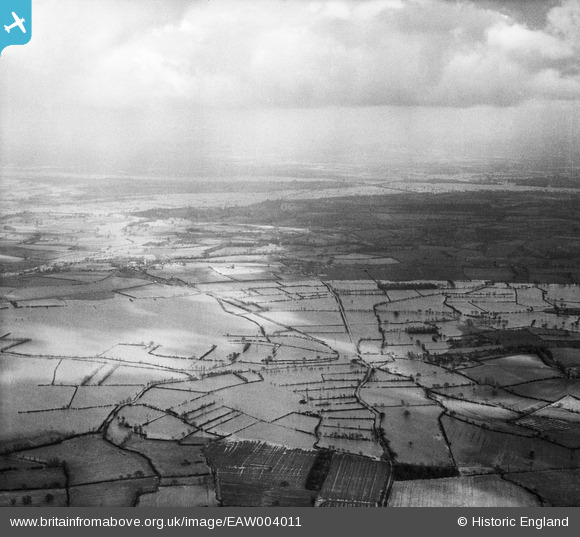
EAW004011 ENGLAND (1947). Flooding at Longdon Marsh and Marsh End, Longdon, from the west, 1947
© Copyright OpenStreetMap contributors and licensed by the OpenStreetMap Foundation. 2026. Cartography is licensed as CC BY-SA.
Details
| Title | [EAW004011] Flooding at Longdon Marsh and Marsh End, Longdon, from the west, 1947 |
| Reference | EAW004011 |
| Date | 21-March-1947 |
| Link | |
| Place name | LONGDON |
| Parish | LONGDON |
| District | |
| Country | ENGLAND |
| Easting / Northing | 381850, 235920 |
| Longitude / Latitude | -2.2645317778216, 52.020979872595 |
| National Grid Reference | SO819359 |
Pins

Class31 |
Wednesday 28th of August 2013 03:00:50 PM | |
|
Class31 |
Wednesday 28th of August 2013 02:58:16 PM | |
|
Class31 |
Wednesday 28th of August 2013 02:55:28 PM | |
|
Class31 |
Wednesday 28th of August 2013 02:51:15 PM | |
|
Class31 |
Wednesday 28th of August 2013 02:49:27 PM | |
|
Class31 |
Wednesday 28th of August 2013 02:45:38 PM |
User Comment Contributions
Photo taken from above Birtsmorton looking east towards Tewkesbury. |
Class31 |
Tuesday 3rd of September 2013 12:58:35 PM |
Hi Class31, Thanks for the location; we'll update the catalogue and post your new data here in due course. Yours, Katy Britain from Above Cataloguing Team Leader |
Katy Whitaker |
Tuesday 3rd of September 2013 12:58:35 PM |
Eureka. I'm pretty sure that I can identify this one! |
Class31 |
Wednesday 28th of August 2013 02:38:11 PM |