
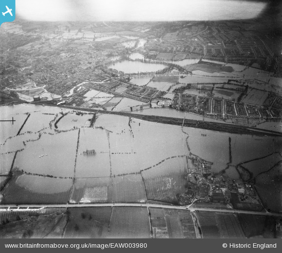
EAW003980 ENGLAND (1947). Flooding around the railway line between South and New Hinksey, South Hinksey, from the south-west, 1947. This image has been produced from a damaged negative.
© Copyright OpenStreetMap contributors and licensed by the OpenStreetMap Foundation. 2026. Cartography is licensed as CC BY-SA.
Details
| Title | [EAW003980] Flooding around the railway line between South and New Hinksey, South Hinksey, from the south-west, 1947. This image has been produced from a damaged negative. |
| Reference | EAW003980 |
| Date | 20-March-1947 |
| Link | |
| Place name | SOUTH HINKSEY |
| Parish | SOUTH HINKSEY |
| District | |
| Country | ENGLAND |
| Easting / Northing | 450797, 204433 |
| Longitude / Latitude | -1.2643106804917, 51.73584552825 |
| National Grid Reference | SP508044 |
Pins

Mike Floate |
Friday 12th of February 2016 08:40:37 PM | |
|
alan_mac |
Wednesday 8th of January 2014 05:12:10 PM | |
|
alan_mac |
Wednesday 8th of January 2014 05:06:59 PM | |
|
alan_mac |
Wednesday 8th of January 2014 05:05:36 PM |