
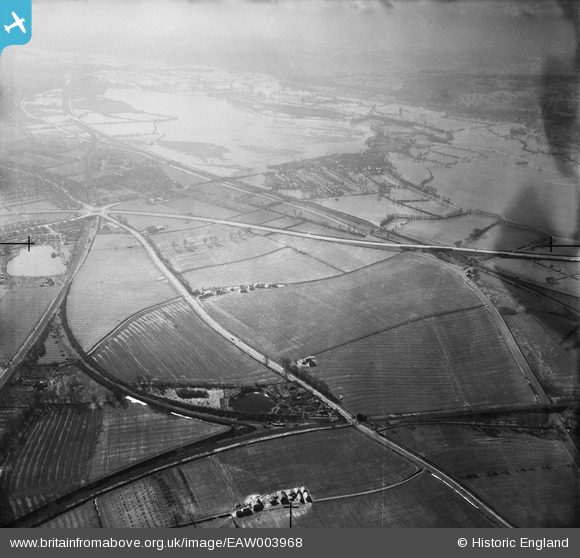
EAW003968 ENGLAND (1947). Peartree Hill and flooding at Wolvercote Common and environs, Yarnton, from the north, 1947
© Copyright OpenStreetMap contributors and licensed by the OpenStreetMap Foundation. 2026. Cartography is licensed as CC BY-SA.
Details
| Title | [EAW003968] Peartree Hill and flooding at Wolvercote Common and environs, Yarnton, from the north, 1947 |
| Reference | EAW003968 |
| Date | 20-March-1947 |
| Link | |
| Place name | YARNTON |
| Parish | GOSFORD AND WATER EATON |
| District | |
| Country | ENGLAND |
| Easting / Northing | 449263, 210985 |
| Longitude / Latitude | -1.2855962638996, 51.79489414991 |
| National Grid Reference | SP493110 |
Pins

David Brimson |
Friday 25th of July 2025 03:37:56 PM | |
|
David Brimson |
Friday 25th of July 2025 03:37:04 PM | |
|
David Brimson |
Friday 25th of July 2025 03:32:26 PM | |
|
SpongeLab |
Friday 9th of October 2020 03:01:29 PM | |
|
SpongeLab |
Friday 9th of October 2020 11:44:59 AM | |
|
SpongeLab |
Friday 9th of October 2020 11:44:23 AM | |
|
SpongeLab |
Friday 9th of October 2020 11:42:43 AM | |
|
SpongeLab |
Friday 9th of October 2020 11:41:51 AM | |
|
SpongeLab |
Friday 9th of October 2020 11:40:58 AM | |
|
SpongeLab |
Friday 9th of October 2020 11:40:18 AM | |
|
SpongeLab |
Friday 9th of October 2020 11:39:49 AM | |
|
SpongeLab |
Thursday 8th of October 2020 12:02:37 PM |