
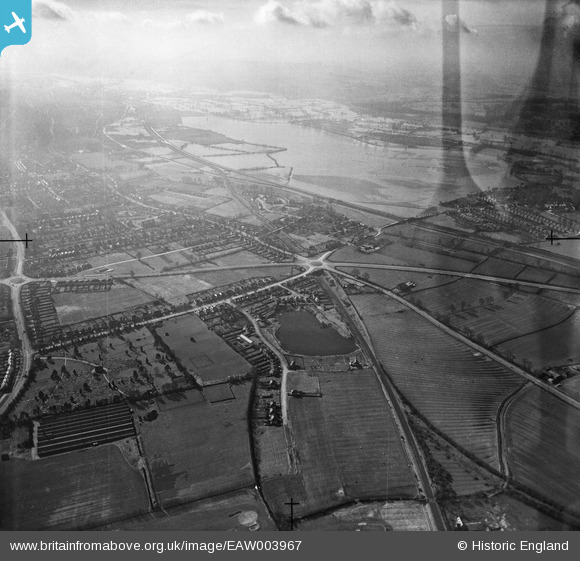
EAW003967 ENGLAND (1947). The Wolvercote Roundabout and flooding at Wolvercote Common and Port Meadow, Wolvercote, from the north-east, 1947. This image has been produced from a damaged negative.
© Copyright OpenStreetMap contributors and licensed by the OpenStreetMap Foundation. 2026. Cartography is licensed as CC BY-SA.
Details
| Title | [EAW003967] The Wolvercote Roundabout and flooding at Wolvercote Common and Port Meadow, Wolvercote, from the north-east, 1947. This image has been produced from a damaged negative. |
| Reference | EAW003967 |
| Date | 20-March-1947 |
| Link | |
| Place name | WOLVERCOTE |
| Parish | |
| District | |
| Country | ENGLAND |
| Easting / Northing | 449871, 210603 |
| Longitude / Latitude | -1.2768348435012, 51.791405561919 |
| National Grid Reference | SP499106 |
