
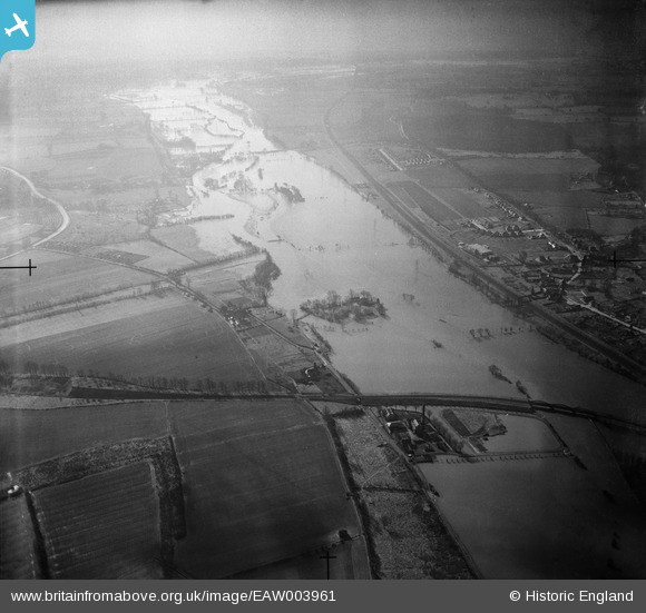
EAW003961 ENGLAND (1947). Flooding around Rose Isle, the Oxford Corporation Sewage Pumping Station and environs, Sandford-on-Thames, from the north, 1947
© Copyright OpenStreetMap contributors and licensed by the OpenStreetMap Foundation. 2025. Cartography is licensed as CC BY-SA.
Details
| Title | [EAW003961] Flooding around Rose Isle, the Oxford Corporation Sewage Pumping Station and environs, Sandford-on-Thames, from the north, 1947 |
| Reference | EAW003961 |
| Date | 20-March-1947 |
| Link | |
| Place name | SANDFORD-ON-THAMES |
| Parish | SANDFORD-ON-THAMES |
| District | |
| Country | ENGLAND |
| Easting / Northing | 452726, 202786 |
| Longitude / Latitude | -1.2366252336023, 51.720858572584 |
| National Grid Reference | SP527028 |
Pins
Be the first to add a comment to this image!