
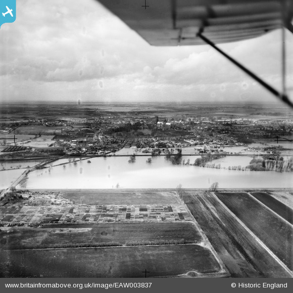
EAW003837 ENGLAND (1947). Flooding of the River Great Ouse at Middle Fen Bank, Ely, from the south-east, 1947
© Copyright OpenStreetMap contributors and licensed by the OpenStreetMap Foundation. 2026. Cartography is licensed as CC BY-SA.
Details
| Title | [EAW003837] Flooding of the River Great Ouse at Middle Fen Bank, Ely, from the south-east, 1947 |
| Reference | EAW003837 |
| Date | March-1947 |
| Link | |
| Place name | ELY |
| Parish | ELY |
| District | |
| Country | ENGLAND |
| Easting / Northing | 554769, 279472 |
| Longitude / Latitude | 0.2746847107508, 52.390983079742 |
| National Grid Reference | TL548795 |
Pins

Matt Aldred edob.mattaldred.com |
Thursday 28th of May 2020 01:44:21 PM |