
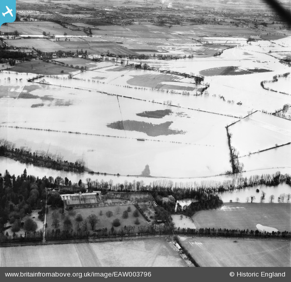
EAW003796 ENGLAND (1947). Flooding at the site of Eton Lake, Dorney, 1947
© Copyright OpenStreetMap contributors and licensed by the OpenStreetMap Foundation. 2026. Cartography is licensed as CC BY-SA.
Details
| Title | [EAW003796] Flooding at the site of Eton Lake, Dorney, 1947 |
| Reference | EAW003796 |
| Date | 19-March-1947 |
| Link | |
| Place name | DORNEY |
| Parish | DORNEY |
| District | |
| Country | ENGLAND |
| Easting / Northing | 492776, 177786 |
| Longitude / Latitude | -0.66352567437923, 51.490914968574 |
| National Grid Reference | SU928778 |
Pins
 St Andrew's Way St Andrew's Way |

designking |
Monday 6th of July 2026 09:30:52 PM |
| Cippenham Junior School |
designking |
Monday 6th of July 2026 09:29:23 PM |
| A4. Bath Road |
designking |
Monday 6th of July 2026 09:27:55 PM |
| Elmshot Lane |
designking |
Monday 6th of July 2026 09:26:35 PM |
| Everitts Corner |
designking |
Monday 6th of July 2026 09:26:08 PM |
| Burnham (Bucks) Station. To reading on the left and to Paddingtom on the right. |
designking |
Monday 6th of July 2026 09:25:34 PM |
| Essoldo cinema |
designking |
Monday 6th of July 2026 09:24:04 PM |
| The Haymill |
designking |
Monday 6th of July 2026 09:23:18 PM |
| GWR railway |
designking |
Monday 6th of July 2026 09:22:36 PM |
| Dover Road bridge into Slough Trading Estate |
designking |
Monday 6th of July 2026 09:21:37 PM |
| the thames? |
dave43 |
Friday 6th of September 2013 10:01:12 PM |