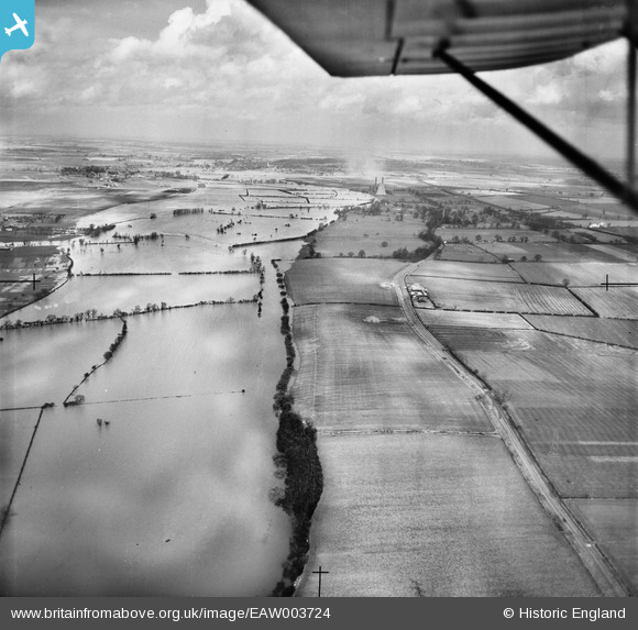
EAW003724 ENGLAND (1947). The River Great Ouse in flood opposite The Barns, Tempsford, from the south-west, 1947
© Copyright OpenStreetMap contributors and licensed by the OpenStreetMap Foundation. 2024. Cartography is licensed as CC BY-SA.
Details
| Title | [EAW003724] The River Great Ouse in flood opposite The Barns, Tempsford, from the south-west, 1947 |
| Reference | EAW003724 |
| Date | 18-March-1947 |
| Link | |
| Place name | TEMPSFORD |
| Parish | TEMPSFORD |
| District | |
| Country | ENGLAND |
| Easting / Northing | 516826, 255271 |
| Longitude / Latitude | -0.29105161020319, 52.182895841776 |
| National Grid Reference | TL168553 |
Pins
 melgibbs |
Tuesday 21st of January 2014 08:26:20 PM |

