
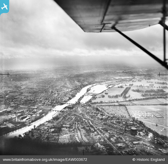
EAW003672 ENGLAND (1947). The River Thames in flood, Hampton Wick, from the north, 1947
© Copyright OpenStreetMap contributors and licensed by the OpenStreetMap Foundation. 2024. Cartography is licensed as CC BY-SA.
Details
| Title | [EAW003672] The River Thames in flood, Hampton Wick, from the north, 1947 |
| Reference | EAW003672 |
| Date | 18-March-1947 |
| Link | |
| Place name | HAMPTON WICK |
| Parish | |
| District | |
| Country | ENGLAND |
| Easting / Northing | 517435, 169801 |
| Longitude / Latitude | -0.31110322349923, 51.414555981637 |
| National Grid Reference | TQ174698 |
Pins
Be the first to add a comment to this image!