
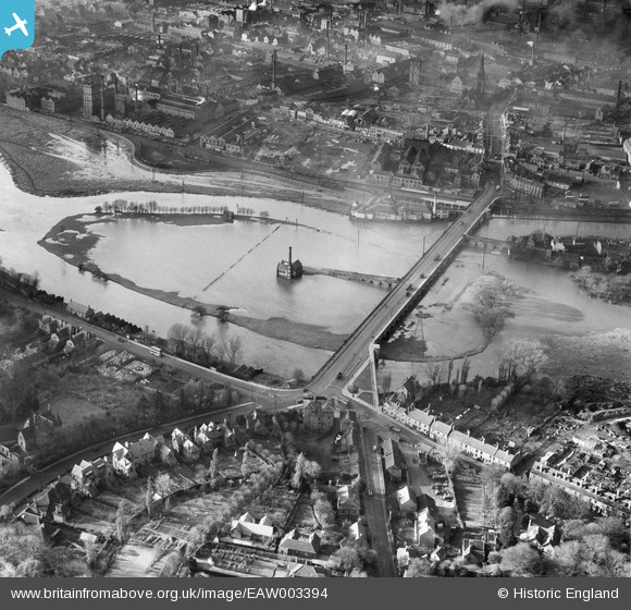
EAW003394 ENGLAND (1946). The River Trent in flood around Burton Bridge, Burton Upon Trent, 1946
© Copyright OpenStreetMap contributors and licensed by the OpenStreetMap Foundation. 2026. Cartography is licensed as CC BY-SA.
Details
| Title | [EAW003394] The River Trent in flood around Burton Bridge, Burton Upon Trent, 1946 |
| Reference | EAW003394 |
| Date | 26-November-1946 |
| Link | |
| Place name | BURTON UPON TRENT |
| Parish | BURTON |
| District | |
| Country | ENGLAND |
| Easting / Northing | 425604, 323191 |
| Longitude / Latitude | -1.620148036489, 52.805332082431 |
| National Grid Reference | SK256232 |
Pins

chris |
Saturday 22nd of November 2025 04:34:00 PM | |
|
Waldemar |
Monday 8th of March 2021 09:56:23 PM | |
|
smed smith |
Thursday 6th of March 2014 07:50:54 AM |