
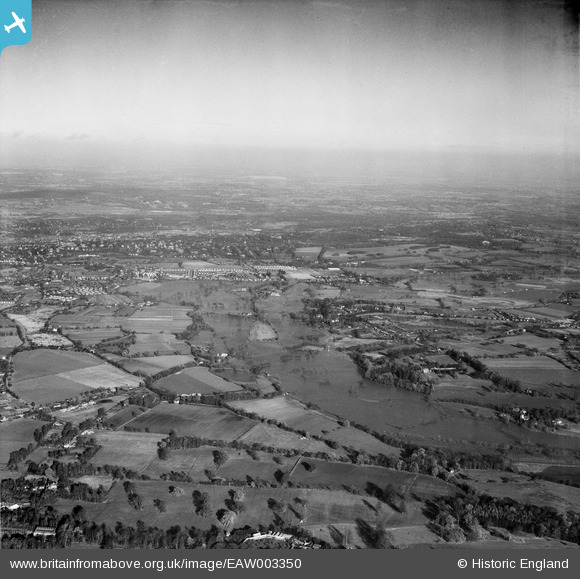
EAW003350 ENGLAND (1946). Flooding of the River Wey between Send and Sutton Park, Sutton Green, from the south-west, 1946
© Copyright OpenStreetMap contributors and licensed by the OpenStreetMap Foundation. 2026. Cartography is licensed as CC BY-SA.
Details
| Title | [EAW003350] Flooding of the River Wey between Send and Sutton Park, Sutton Green, from the south-west, 1946 |
| Reference | EAW003350 |
| Date | 13-November-1946 |
| Link | |
| Place name | SUTTON GREEN |
| Parish | |
| District | |
| Country | ENGLAND |
| Easting / Northing | 501098, 154531 |
| Longitude / Latitude | -0.55030575948332, 51.280430369606 |
| National Grid Reference | TQ011545 |
Pins
 Unwin Brothers Unwin Brothers |

Shema Yisrael |
Monday 17th of August 2026 11:47:45 AM |
| Kingfield |
Frank Phillipson |
Thursday 30th of July 2020 08:52:08 PM |
| Send Church. |
Frank Phillipson |
Thursday 30th of July 2020 08:47:34 PM |
| Old Woking church. |
Frank Phillipson |
Thursday 30th of July 2020 08:46:46 PM |