
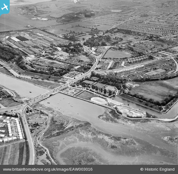
EAW003016 ENGLAND (1946). Ports Bridge, Ports Creek, Hilsea Lido and environs, Hilsea, 1946
© Copyright OpenStreetMap contributors and licensed by the OpenStreetMap Foundation. 2026. Cartography is licensed as CC BY-SA.
Details
| Title | [EAW003016] Ports Bridge, Ports Creek, Hilsea Lido and environs, Hilsea, 1946 |
| Reference | EAW003016 |
| Date | 3-October-1946 |
| Link | |
| Place name | HILSEA |
| Parish | |
| District | |
| Country | ENGLAND |
| Easting / Northing | 465400, 104356 |
| Longitude / Latitude | -1.0711757582274, 50.83447584542 |
| National Grid Reference | SU654044 |
Pins

ianhenden |
Monday 12th of September 2022 04:52:19 PM | |
|
John Wass |
Tuesday 19th of January 2016 02:06:04 PM | |
|
hoppy |
Thursday 20th of November 2014 03:14:26 AM | |
|
5tumb1ebum |
Friday 25th of July 2014 10:53:06 PM | |
|
jrussill |
Wednesday 8th of January 2014 06:01:14 PM | |
|
elanbretta |
Wednesday 28th of August 2013 01:52:18 PM | |

greenchief |
Tuesday 27th of August 2013 02:58:20 PM | |
Demolished August 2013 |
elanbretta |
Wednesday 28th of August 2013 01:13:07 PM |
|
greenchief |
Tuesday 27th of August 2013 02:57:04 PM | |
|
greenchief |
Tuesday 27th of August 2013 02:55:58 PM |
User Comment Contributions
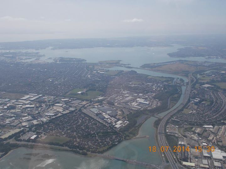
A distant aerial view looking west, 18.07.2014 courtesy Con Shields. |

Class31 |
Tuesday 22nd of July 2014 07:44:56 AM |