
Downtime message
Due to planned maintenance taking place on Thursday 9th October between 9:00 AM and 1:00 PM, services might be disrupted or temporarily unavailable. We apologise for any inconvenience.
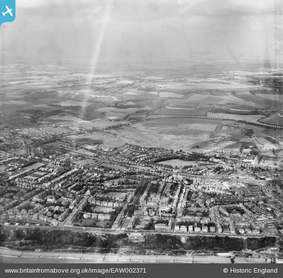
EAW002371 ENGLAND (1946). The area between Clifton Gardens and Radnor Park, Folkestone, from the south-east, 1946
© Copyright OpenStreetMap contributors and licensed by the OpenStreetMap Foundation. 2025. Cartography is licensed as CC BY-SA.
Details
| Title | [EAW002371] The area between Clifton Gardens and Radnor Park, Folkestone, from the south-east, 1946 |
| Reference | EAW002371 |
| Date | 9-September-1946 |
| Link | |
| Place name | FOLKESTONE |
| Parish | FOLKESTONE |
| District | |
| Country | ENGLAND |
| Easting / Northing | 622161, 136027 |
| Longitude / Latitude | 1.1721559377588, 51.079949458426 |
| National Grid Reference | TR222360 |
Pins

redmist |
Thursday 13th of February 2025 11:30:59 PM |