
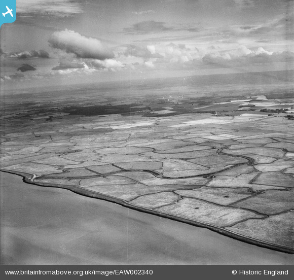
EAW002340 ENGLAND (1946). Cliffe Marshes, Cliffe, from the north-west, 1946
© Copyright OpenStreetMap contributors and licensed by the OpenStreetMap Foundation. 2026. Cartography is licensed as CC BY-SA.
Details
| Title | [EAW002340] Cliffe Marshes, Cliffe, from the north-west, 1946 |
| Reference | EAW002340 |
| Date | 5-September-1946 |
| Link | |
| Place name | CLIFFE |
| Parish | CLIFFE AND CLIFFE WOODS |
| District | |
| Country | ENGLAND |
| Easting / Northing | 574774, 178252 |
| Longitude / Latitude | 0.51697976381805, 51.475704938023 |
| National Grid Reference | TQ748783 |
Pins

redmist |
Monday 27th of July 2020 11:52:06 AM |