
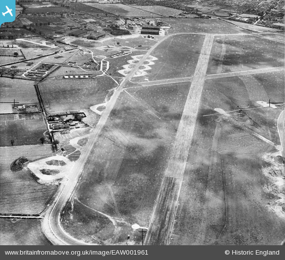
EAW001961 ENGLAND (1946). RAF Horsham St Faith, Norwich, 1946. This image has been produced from a damaged negative.
© Copyright OpenStreetMap contributors and licensed by the OpenStreetMap Foundation. 2026. Cartography is licensed as CC BY-SA.
Details
| Title | [EAW001961] RAF Horsham St Faith, Norwich, 1946. This image has been produced from a damaged negative. |
| Reference | EAW001961 |
| Date | 25-July-1946 |
| Link | |
| Place name | NORWICH |
| Parish | |
| District | |
| Country | ENGLAND |
| Easting / Northing | 622415, 313989 |
| Longitude / Latitude | 1.2905040629017, 52.677524052464 |
| National Grid Reference | TG224140 |
Pins

Matt Aldred edob.mattaldred.com |
Sunday 16th of February 2025 12:21:44 PM | |
|
Matt Aldred edob.mattaldred.com |
Sunday 16th of February 2025 12:21:09 PM | |

redmist |
Tuesday 23rd of November 2021 07:48:49 PM | |
|
redmist |
Tuesday 23rd of November 2021 07:46:51 PM | |
|
redmist |
Tuesday 23rd of November 2021 07:42:11 PM | |
|
sum0 |
Wednesday 15th of April 2020 09:09:49 PM | |
|
sum0 |
Wednesday 15th of April 2020 09:09:19 PM | |
|
sum0 |
Wednesday 15th of April 2020 09:03:14 PM |