
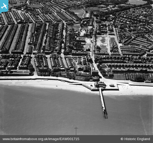
EAW001715 ENGLAND (1946). Egremont Pier, Church Street and environs, Egremont, 1946
© Copyright OpenStreetMap contributors and licensed by the OpenStreetMap Foundation. 2026. Cartography is licensed as CC BY-SA.
Details
| Title | [EAW001715] Egremont Pier, Church Street and environs, Egremont, 1946 |
| Reference | EAW001715 |
| Date | 11-July-1946 |
| Link | |
| Place name | EGREMONT |
| Parish | |
| District | |
| Country | ENGLAND |
| Easting / Northing | 331983, 391763 |
| Longitude / Latitude | -3.0235358282934, 53.418019508402 |
| National Grid Reference | SJ320918 |
Pins

flagermus |
Friday 13th of January 2023 02:50:38 PM | |
|
flagermus |
Friday 13th of January 2023 02:49:15 PM | |
|
flagermus |
Friday 13th of January 2023 02:48:06 PM | |
|
Jess |
Monday 20th of November 2017 07:12:06 PM | |
|
Jess |
Monday 20th of November 2017 07:10:32 PM | |
|
Jess |
Monday 20th of November 2017 06:58:07 PM | |
 |
Dave Firth |
Tuesday 3rd of January 2017 06:09:45 PM |
