
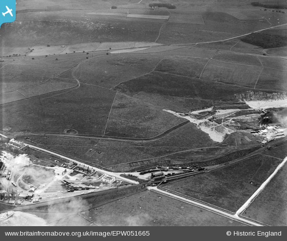
EPW051665 ENGLAND (1936). Hindlow Railway Station and environs, Hind Low, 1936
© Hawlfraint cyfranwyr OpenStreetMap a thrwyddedwyd gan yr OpenStreetMap Foundation. 2024. Trwyddedir y gartograffeg fel CC BY-SA.
Delweddau cyfagos (5)
EPW051665

EPW051657

EPW051664

EPW051669

EPW051655

Manylion
| Pennawd | [EPW051665] Hindlow Railway Station and environs, Hind Low, 1936 |
| Cyfeirnod | EPW051665 |
| Dyddiad | August-1936 |
| Dolen | |
| Enw lle | HIND LOW |
| Plwyf | HARTINGTON UPPER QUARTER |
| Ardal | |
| Gwlad | ENGLAND |
| Dwyreiniad / Gogleddiad | 408337, 369114 |
| Hydred / Lledred | -1.8751278200856, 53.218731410987 |
| Cyfeirnod Grid Cenedlaethol | SK083691 |
Pinnau
 DaveH |
Friday 15th of December 2017 09:30:39 AM | |
DaveH |
Friday 15th of December 2017 09:26:40 AM | |
Louis Heath |
Saturday 14th of December 2013 04:30:52 PM |
Cyfraniadau Grŵp
This station was on the Cromford and Peak Forest line, originally built to link the Peak Forest canal at Whaley Bridge to the Cromford Canal at Cromford, since a canal could not be constructed across the hilly countryside. In 1895 the L&NWR built a link from the line to their line at Buxton and an extension at Parsley Hay to Ashbourne. I understand this station dates from that period. It was closed in 1954. This part of the line remains open as a freight-only line serving the quarries south of Buxton. |
John W |
Tuesday 16th of May 2017 09:21:47 PM |


