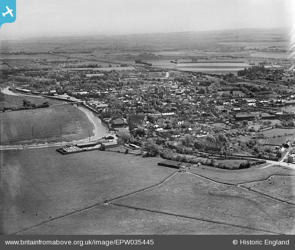
EPW035445 ENGLAND (1931). The town and surroundings, Sandwich, from the north-west, 1931
© Hawlfraint cyfranwyr OpenStreetMap a thrwyddedwyd gan yr OpenStreetMap Foundation. 2024. Trwyddedir y gartograffeg fel CC BY-SA.
Delweddau cyfagos (2)
EPW035445

EPW035442

Manylion
| Pennawd | [EPW035445] The town and surroundings, Sandwich, from the north-west, 1931 |
| Cyfeirnod | EPW035445 |
| Dyddiad | May-1931 |
| Dolen | |
| Enw lle | SANDWICH |
| Plwyf | SANDWICH |
| Ardal | |
| Gwlad | ENGLAND |
| Dwyreiniad / Gogleddiad | 632806, 158611 |
| Hydred / Lledred | 1.3385120059955, 51.278484035227 |
| Cyfeirnod Grid Cenedlaethol | TR328586 |
Pinnau
 Stu Giles |
Thursday 17th of May 2018 09:27:53 AM | |
 Alan McFaden |
Wednesday 9th of July 2014 11:28:18 AM | |
Alan McFaden |
Wednesday 9th of July 2014 11:27:42 AM |