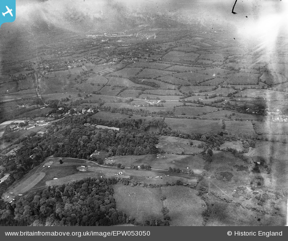
epw053050 ENGLAND (1937). Brockley Hill Golf Course and environs, Canons Park, from the south-west, 1937
© Copyright OpenStreetMap contributors and licensed by the OpenStreetMap Foundation. 2024. Cartography is licensed as CC BY-SA.
Nearby Images (7)
Details
| Title | [EPW053050] Brockley Hill Golf Course and environs, Canons Park, from the south-west, 1937 |
| Reference | EPW053050 |
| Date | 17-May-1937 |
| Link | |
| Place name | CANONS PARK |
| Parish | |
| District | |
| Country | ENGLAND |
| Easting / Northing | 517260, 193243 |
| Longitude / Latitude | -0.30581646612309, 51.625302026475 |
| National Grid Reference | TQ173932 |
Pins
 John Llewellyn |
Tuesday 1st of December 2015 11:54:53 AM | |
 Ian K |
Thursday 20th of February 2014 01:37:02 PM | |
 Ian K |
Thursday 20th of February 2014 01:35:35 PM | |
 Ian K |
Thursday 20th of February 2014 01:33:09 PM | |
 Ian K |
Thursday 20th of February 2014 01:32:31 PM | |
 Ian K |
Thursday 20th of February 2014 01:31:52 PM | |
 Ian K |
Thursday 20th of February 2014 01:31:04 PM | |
 Ian K |
Thursday 20th of February 2014 01:30:38 PM |


![[EPW053050] Brockley Hill Golf Course and environs, Canons Park, from the south-west, 1937](http://britainfromabove.org.uk/sites/all/libraries/aerofilms-images/public/100x100/EPW/053/EPW053050.jpg)
![[EAW026807] Part of the Stanmore Country Park Nature Reserve, Stanmore, 1949](http://britainfromabove.org.uk/sites/all/libraries/aerofilms-images/public/100x100/EAW/026/EAW026807.jpg)
![[EAW026805] Part of the Stanmore Country Park Nature Reserve, Stanmore, 1949](http://britainfromabove.org.uk/sites/all/libraries/aerofilms-images/public/100x100/EAW/026/EAW026805.jpg)
![[EAW020706] Brockley Hill, Stanmore, from the south-east, 1948](http://britainfromabove.org.uk/sites/all/libraries/aerofilms-images/public/100x100/EAW/020/EAW020706.jpg)
![[EAW026804] Part of the Stanmore Country Park Nature Reserve, Stanmore, 1949](http://britainfromabove.org.uk/sites/all/libraries/aerofilms-images/public/100x100/EAW/026/EAW026804.jpg)
![[EAW020707] Brockley Hill and Stanmore Common, Stanmore, from the south-east, 1948](http://britainfromabove.org.uk/sites/all/libraries/aerofilms-images/public/100x100/EAW/020/EAW020707.jpg)
![[EAW026806] Part of the Stanmore Country Park Nature Reserve, Stanmore, 1949](http://britainfromabove.org.uk/sites/all/libraries/aerofilms-images/public/100x100/EAW/026/EAW026806.jpg)