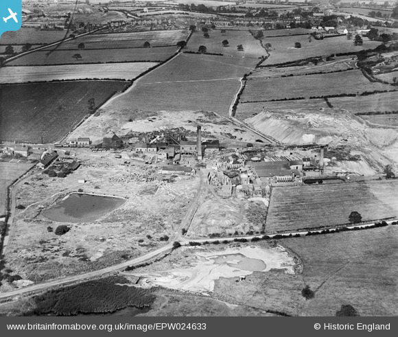
epw024633 ENGLAND (1928). The Tame Valley Colliery, Wilnecote, 1928
© Copyright OpenStreetMap contributors and licensed by the OpenStreetMap Foundation. 2024. Cartography is licensed as CC BY-SA.
Details
| Title | [EPW024633] The Tame Valley Colliery, Wilnecote, 1928 |
| Reference | EPW024633 |
| Date | September-1928 |
| Link | |
| Place name | WILNECOTE |
| Parish | |
| District | |
| Country | ENGLAND |
| Easting / Northing | 422161, 300521 |
| Longitude / Latitude | -1.6727542960584, 52.601669475444 |
| National Grid Reference | SK222005 |
Pins
 Mr |
Friday 28th of October 2016 12:23:33 PM | |
 Toby Clempson |
Wednesday 22nd of August 2012 07:35:32 AM | |
 Toby Clempson |
Wednesday 22nd of August 2012 07:35:02 AM | |
 Toby Clempson |
Wednesday 22nd of August 2012 07:34:09 AM | |
Did Valley lane end opposite Wilnecote motors next to the Parish hall? |
 Mr |
Friday 28th of October 2016 12:33:32 PM |
 Toby Clempson |
Wednesday 22nd of August 2012 07:29:19 AM | |
 Toby Clempson |
Wednesday 22nd of August 2012 07:27:19 AM | |
 Toby Clempson |
Wednesday 22nd of August 2012 07:26:32 AM | |
 Toby Clempson |
Wednesday 22nd of August 2012 07:25:56 AM | |
 Toby Clempson |
Wednesday 22nd of August 2012 07:25:25 AM |


