
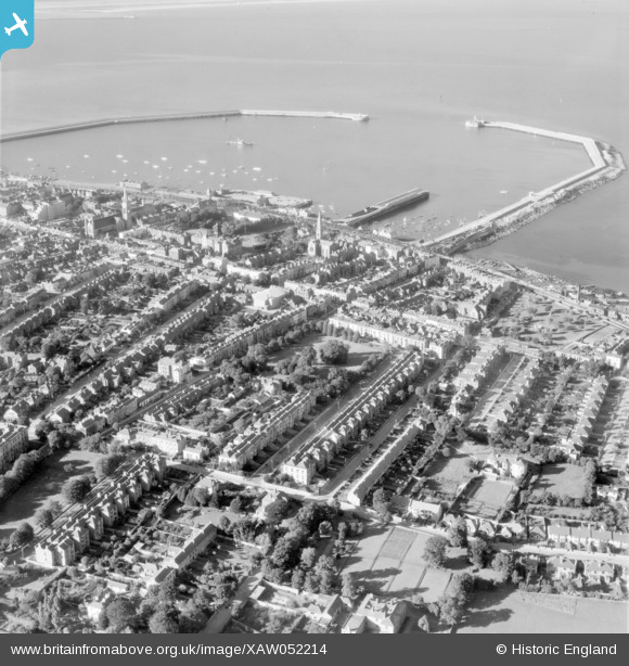
XAW052214 IRELAND (1953). Dun Laoghaire Spec, Dun Laoghaire, Dublin, Ireland, 1953. Oblique aerial photograph taken facing North.
© Copyright OpenStreetMap contributors and licensed by the OpenStreetMap Foundation. 2024. Cartography is licensed as CC BY-SA.
Nearby Images (5)
XAW052214

XAW040458

XAW040452

XAW040455

XAW045384

Details
| Title | [XAW052214] Dun Laoghaire Spec, Dun Laoghaire, Dublin, Ireland, 1953. Oblique aerial photograph taken facing North. |
| Reference | XAW052214 |
| Date | 1953 |
| Link | |
| Place name | DUN LAOGHAIRE |
| Parish | IRELAND |
| District | |
| Country | IRELAND |
| Easting / Northing | 124711, 384685 |
| Longitude / Latitude | -6.131861, 53.287439 |
| National Grid Reference |


