
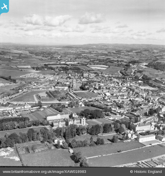
XAW018983 IRELAND (1948). General View, Kilkenny, Kilkenny, Ireland, 1948. Oblique aerial photograph taken facing North.
© Copyright OpenStreetMap contributors and licensed by the OpenStreetMap Foundation. 2024. Cartography is licensed as CC BY-SA.
Nearby Images (2)
XAW018983

XAW027141

Details
| Title | [XAW018983] General View, Kilkenny, Kilkenny, Ireland, 1948. Oblique aerial photograph taken facing North. |
| Reference | XAW018983 |
| Date | 21-September-1948 |
| Link | |
| Place name | KILKENNY |
| Parish | IRELAND |
| District | |
| Country | IRELAND |
| Easting / Northing | 44657, 319064 |
| Longitude / Latitude | -7.256045, 52.652523 |
| National Grid Reference |
Pins
 John Byrne |
Friday 23rd of June 2017 07:04:12 PM | |
John Byrne |
Friday 23rd of June 2017 04:58:49 PM | |
 John Swain |
Friday 10th of October 2014 05:04:45 PM | |
John Swain |
Friday 10th of October 2014 05:01:36 PM | |
John Swain |
Friday 10th of October 2014 04:53:31 PM | |
John Swain |
Friday 10th of October 2014 04:52:19 PM | |
John Swain |
Friday 10th of October 2014 04:46:40 PM | |
John Swain |
Friday 10th of October 2014 04:45:58 PM | |
John Swain |
Friday 10th of October 2014 04:45:25 PM | |
John Swain |
Friday 10th of October 2014 04:44:52 PM | |
John Swain |
Friday 10th of October 2014 04:44:12 PM | |
John Swain |
Friday 10th of October 2014 04:43:26 PM | |
John Swain |
Friday 10th of October 2014 04:42:45 PM |


